Recherches récentes
Options de recherche

#geopandas


Something going on with #geopandas on #Windows today that broke @movingpandas unit tests? https://github.com/movingpandas/movingpandas/actions/runs/14266650165/job/39992053542


Seeking recommendations for a #WebMapping tutorial / course?
Slightly at sea on where to start.
- My current JS skill level is _extreme novice_.
- I don't have access to ArcGIS.
- Comfortable with #QGIS [*] and the #python #geospatial ecosystem (#geopandas #xarray #rasterio and plotting with #matplotlib)
Suggestions welcome. TIA. 
* I have looked at the qgis2web plugin, but having some issues associated with my aged laptop (2012 mbp running Ubuntu) and a 'Wayland session'.
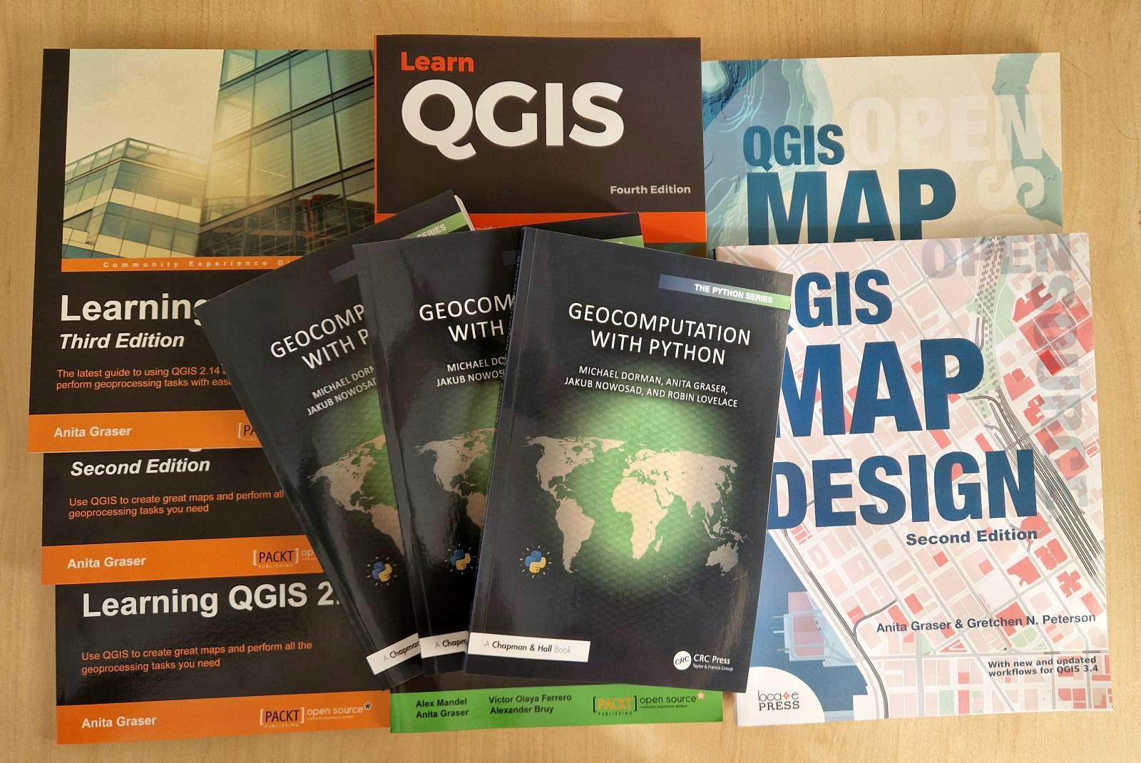
 Geocomputation with Python copies have arrived
Somehow, things feel much more real if you can touch them.
Fun fact: the cover was designed in #QGIS. Speaking of going full circle ...
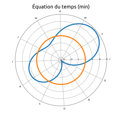
Une carte complètement inutile, donc indispensable. À quelle latitude le Soleil survole-t-il le plus de terres émergées ?
#Python #Geopandas
#maps #TeamCarto
. Dans la zone intertropicale, des lignes horizontales barrent les continents ; leur couleur va de l'orange clair au rouge. À gauche, dans le Pacifique, un histogramme à barres horizontales avec les mêmes lignes colorées. En légende en bas : maximum 36.7% de terres émergées, latitude 22.97° 10 juin et 4 juillet.")

@christyheaton kicks us off at #pycascades2025 by talking about how to make hiking maps with #pyscript, #geopandas, and #streamlit 


#pycascades #python


helped create maps of rail transit + population density for 250 cities
#maps #transit #geopandas #openstreetmap
https://schoolofcities.github.io/rail-transit-and-population-density

"R⁵py is a #Python library for rapid realistic routing on multimodal transport networks (walk, bike, public transport, and car). It provides a simple and friendly interface to R⁵, the Rapid Realistic Routing on Real-world and Reimagined networks, a routing engine developed by Conveyal. #r5py is inspired by r5r, a wrapper for R, and it is designed to interact with #GeoPandas #GeoDataFrames."
https://r5py.readthedocs.io/en/stable/index.html
via @waeiski